France · Metz
Fort de Queuleu
Data is aggregated from public sources and may be incomplete or out of date. Always verify with primary sources before acting on any figure. See data sources.
For families
How to send mail, money, and visit Fort de Queuleu
Step-by-step guidance using the France system — addresses, money services, visit booking, what to bring on your first visit.
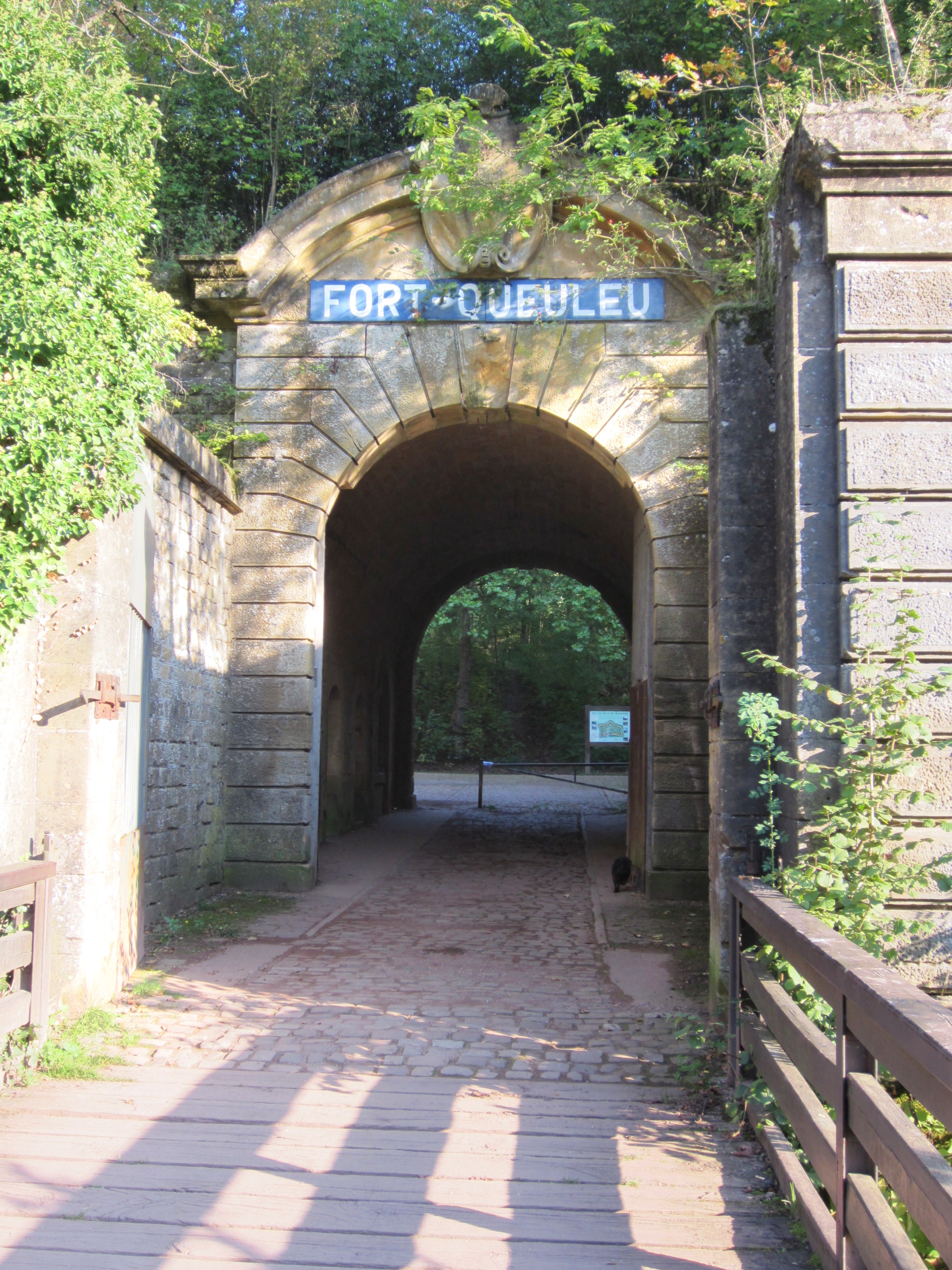
Gallery
From Wikimedia Commons (CC-BY-SA where not otherwise stated).

Photo by Unknown authorUnknown author or not provided via Wikimedia Commons (Public domain)

Photo by AnonymousUnknown author via Wikimedia Commons (Public domain)

Photo by Annick Monnier via Wikimedia Commons (CC BY-SA 4.0)

Photo by JuJu939 via Wikimedia Commons (CC BY-SA 4.0)

Photo by Aimelaime at French Wikipedia via Wikimedia Commons (Public domain)

Photo by Ètefan JurcÄ from Paris, France via Wikimedia Commons (CC BY 2.0)
Background
The Fort de Queuleu (French pronunciation: [fÉÊ dÉ kølø]) is a fortification to the southeast of Metz, near Queuleu, France. Construction began while part of Lorraine was under French rule in 1868. After the interruption of the Franco-Prussian War of 1870-71, the fort was improved between 1872 and 1875 by the German Empire, which had conquered the area in the war. Renamed Fort Goeben, it formed part of the first ring of the fortifications of Metz.
Source: Wikipedia article lead, CC-BY-SA.
Capacity
—
Current population
—
Occupancy
—
Year opened
1868
Operational
Figures from official sources · verified 29 May 2026 · methodology
Facility profile
Operator
—
Population held
Mixed/unknown
Opened
1868
Region
Metz
Security level
—
Death-row facility
No
Conditions
No conditions summary available yet.
Visiting
No visiting information available.
Mailing
No mailing information available.
Practical info
Contact the operator's website for inmate-specific procedures.
Known issues
No major issues documented in our database.
Contact & address
Conditions Risk Score
Derived signal — not a judgement. How it's calculated
Related facilities
Same country, matched on type + security level where possible.
- Maison d'arrêt BayonneBayonnepretrialMaison d'arrêt209% occupancy
- Maison d'arrêt CarcassonnepretrialMaison d'arrêt236% occupancy
- Maison d'arrêt LimogesLimogespretrialMaison d'arrêt219% occupancy
- Maison d'arrêt VannespretrialMaison d'arrêt200% occupancy
- Maison d'arrêt AuxerreAuxerrepretrialMaison d'arrêt208% occupancy
- Maison d'arrêt AmiensAmienspretrialMaison d'arrêt212% occupancy
Data completeness
20%How many of our profile fields are populated. We surface this so families and researchers know the limits.
Sources
- Wikipedia — Wikimedia Foundation
- OpenStreetMap — OpenStreetMap Contributors
- Wikidata — Wikimedia Foundation
- Wikidata (Q820008)
- Wikipedia
- Wikimedia Commons
- See /data-sources for our overall methodology.
Cite this page
Under CC-BY-4.0. Include the URL and access date; the site is a living reference and entries can change.
World Prisons. (2026). Fort de Queuleu. Retrieved October 20, 2026, from https://worldprisons.com/prisons/fort-de-queuleu
"Fort de Queuleu." World Prisons. Accessed October 20, 2026. https://worldprisons.com/prisons/fort-de-queuleu.
@misc{worldprisons-fort-de-queuleu,
  author = {{World Prisons}},
  title = {Fort de Queuleu},
  year = {2026},
  url = {https://worldprisons.com/prisons/fort-de-queuleu},
  urldate = {2026-10-20}
}